


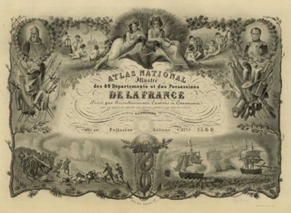
496
Victor Levasseur
Atlas national France. 1869
Stima:
€ 500 / $ 525 Risultato:
€ 780 / $ 819 ( commissione inclusa)
Cf. Phillips 3000. - Pelissier edition of the atlas that was first published in 1847. - Contains maps of the departments, 1 world map, maps of the continents Europe, Africa, Asia and Australia/Oceania, 2 maps of the American continent (North and South America) and 5 maps of French colonies. - The nice title leaf with portraits of Charlemagne and Napoleon as well as illustrations of battles on sea and on land from Napoleon's wars. The decorative maps are framed by broad boarders (of which 2 coloured), which show views of landscapes and towns, portraits, costumes, crafts, farming and products from the regions as well as indications on statistics, economy, administration, important cities and people etc. - 1 map lacking (no. 90). Partly slightly stained in the white margin, binding somewhat damaged at the beginning; endpapers, binding and spine renewed.
496
Victor Levasseur
Atlas national France. 1869
Stima:
€ 500 / $ 525 Risultato:
€ 780 / $ 819 ( commissione inclusa)